Wind Measurement
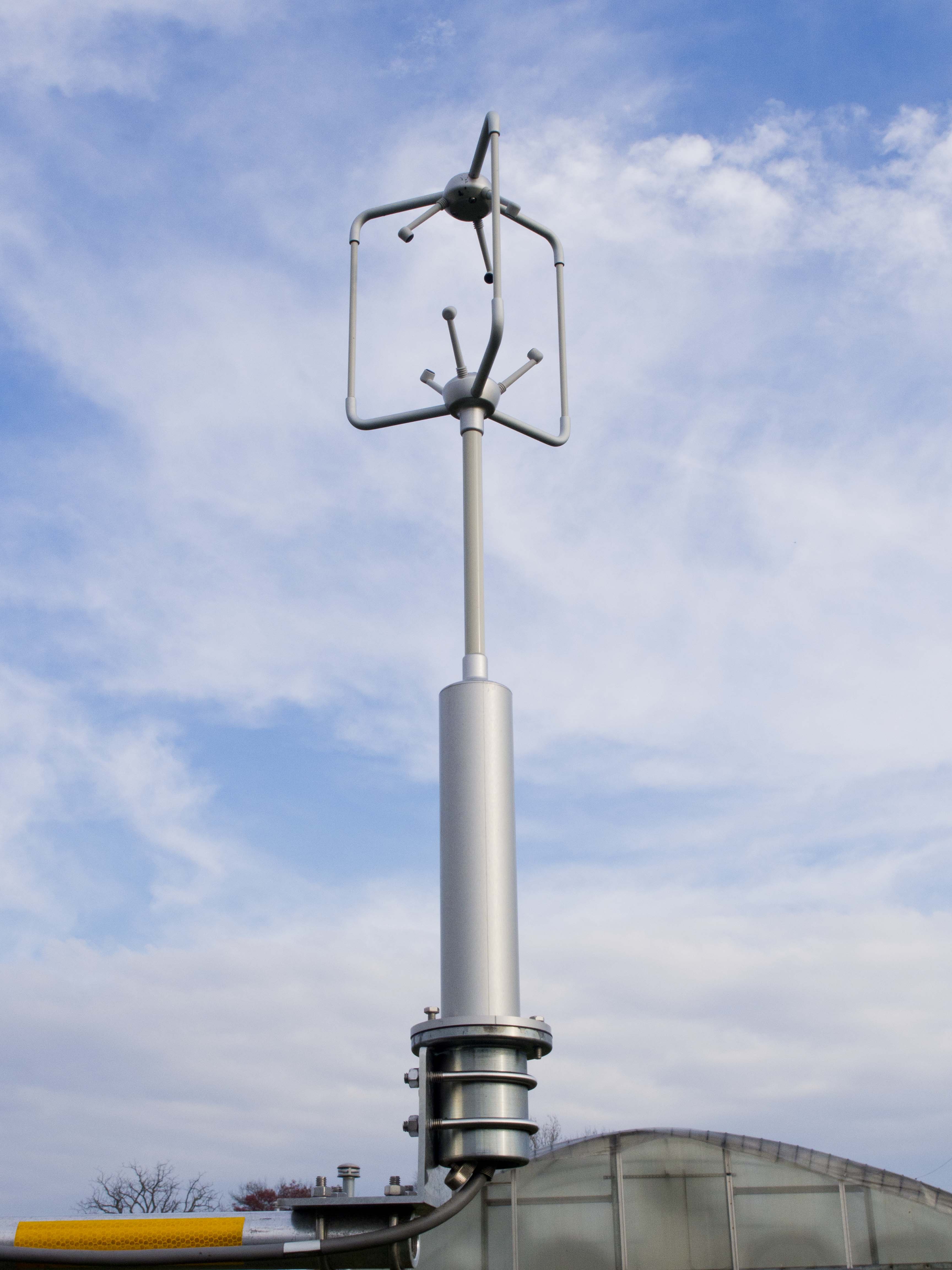
Gill R3-100 3-D Sonic Anemometer
Location(s): Met Tower, 2 meters above ground level.
Output: Wind Speed/Dir, 3 dimensions
Installed: 2014
Description: The Gill R3-100 sonic anemometer measures wind speed and direction with an extremely high sensitivty and sampling rate, allowing for very precise wind speed and direction measurments horizontally as well as veritcally.
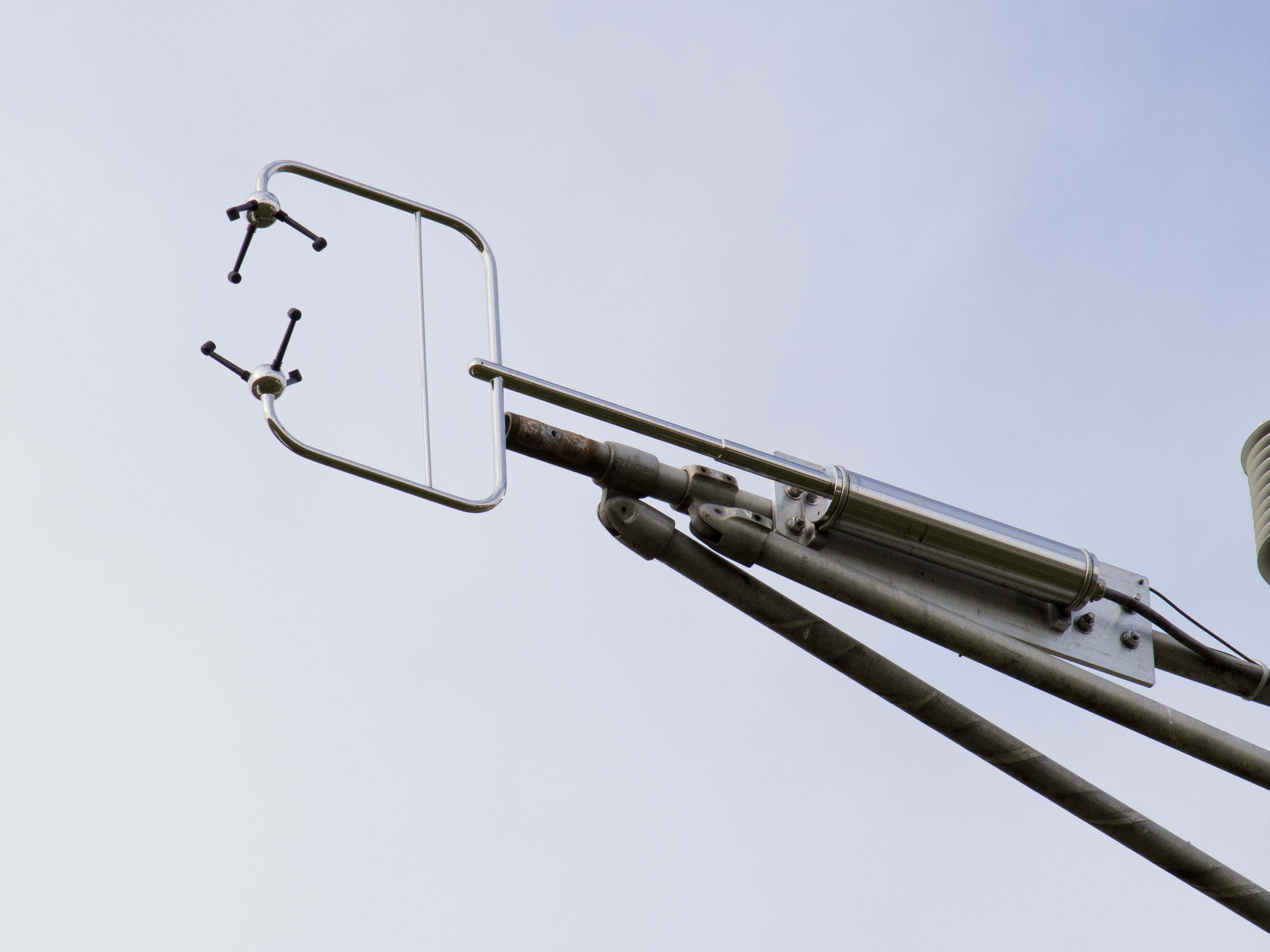
Gill Windmaster HS 3-D Sonic Anemometer
Location(s): Met Tower: 10 & 20 meters above ground level.
Output: Wind Speed/Dir, 3 dimensions
Installed: 2014
Description: The Gill Windmaster HS is a tough sonic anemometer that is mounted on a horizontal boom, allowing for less obstructed vertical wind speed measurements.
Temperature and Moisture
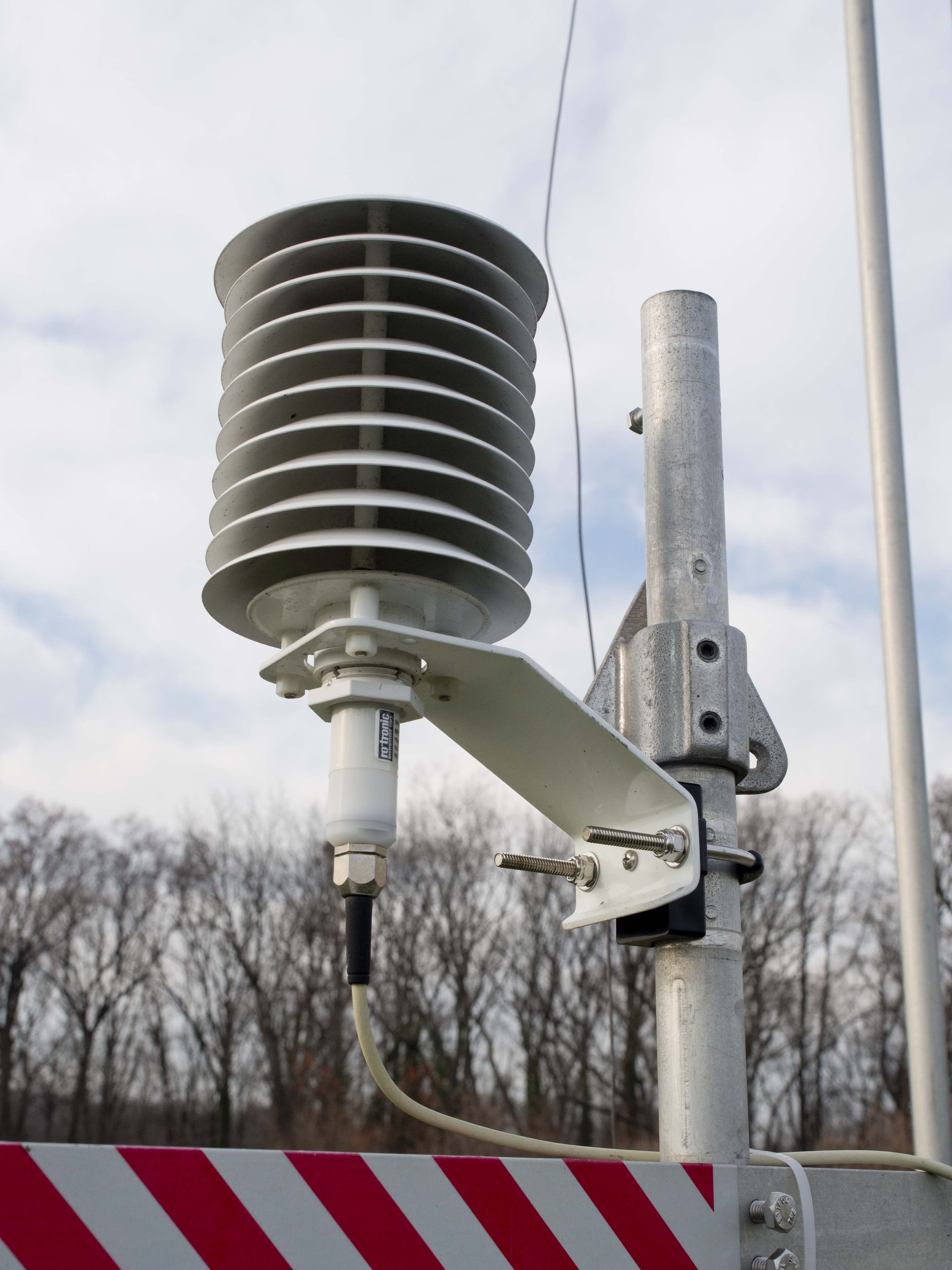
Climatronics Temperature and Relative Humidity Sensor
Location(s): Met Tower: 2, 10, & 20 meters above ground level.
Output: Temperature, Relative Humidity, and Dewpoint (calculated using temp/RH)
Installed: 2014
Description: Naturally aspirated, highly sensitive temperature and relative humidity sensors providing years of precise measurements.
Precipitation
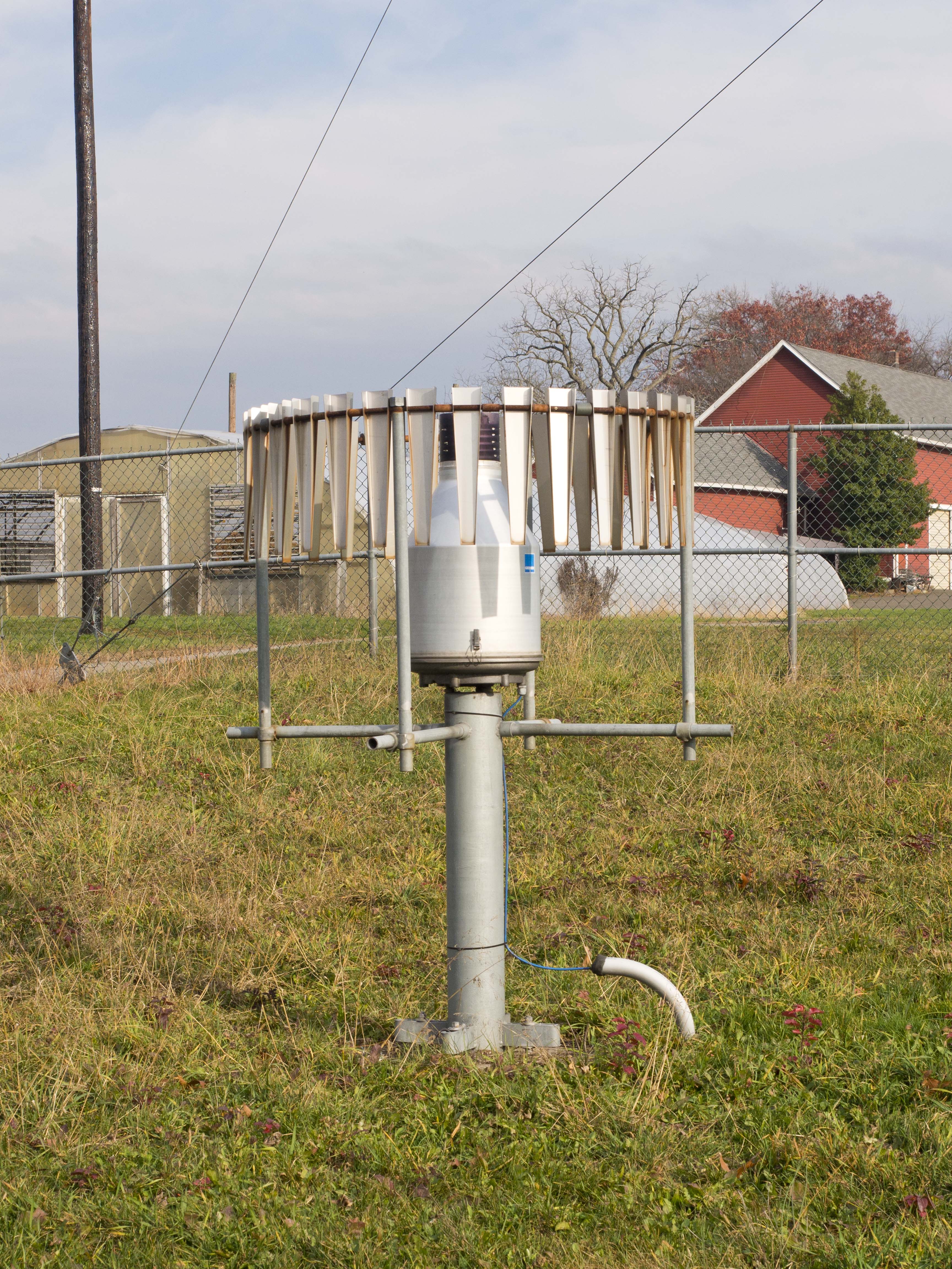
Geonor Frequency Rain Gauge
Location(s): Ground level.
Output: Rainfall (inches/milimeters)
Installed: 2001
Description: Frequency rain gauges measure the amount of rainfall by 'weighing' the amount of rain that has fallen into an internal bucket. A virbrating wire-load sensor will change frequency when more precipitation has been added to the bucket and difference in frequencies can be translated into an accumulation of rainfall in inches (or any unit of distance of your chosing). The result is a more precise rainfall measurement than a traditional tipping-bucket style rain gauge. The disadvantage is the bucket does need to be emptied manually once or twice a year. The long metal flaps surrounding the gauge act to calm the air around the gauge, which contributes to a more accurate rainfal measurement in high wind situations.
In the winter time, anti-freeze is added to the internal bucket to prevent freezing, and to allow for the measurement of the liquid-content of any snowfall the site may recieve.
Incoming Solar Radiation (Sunlight)
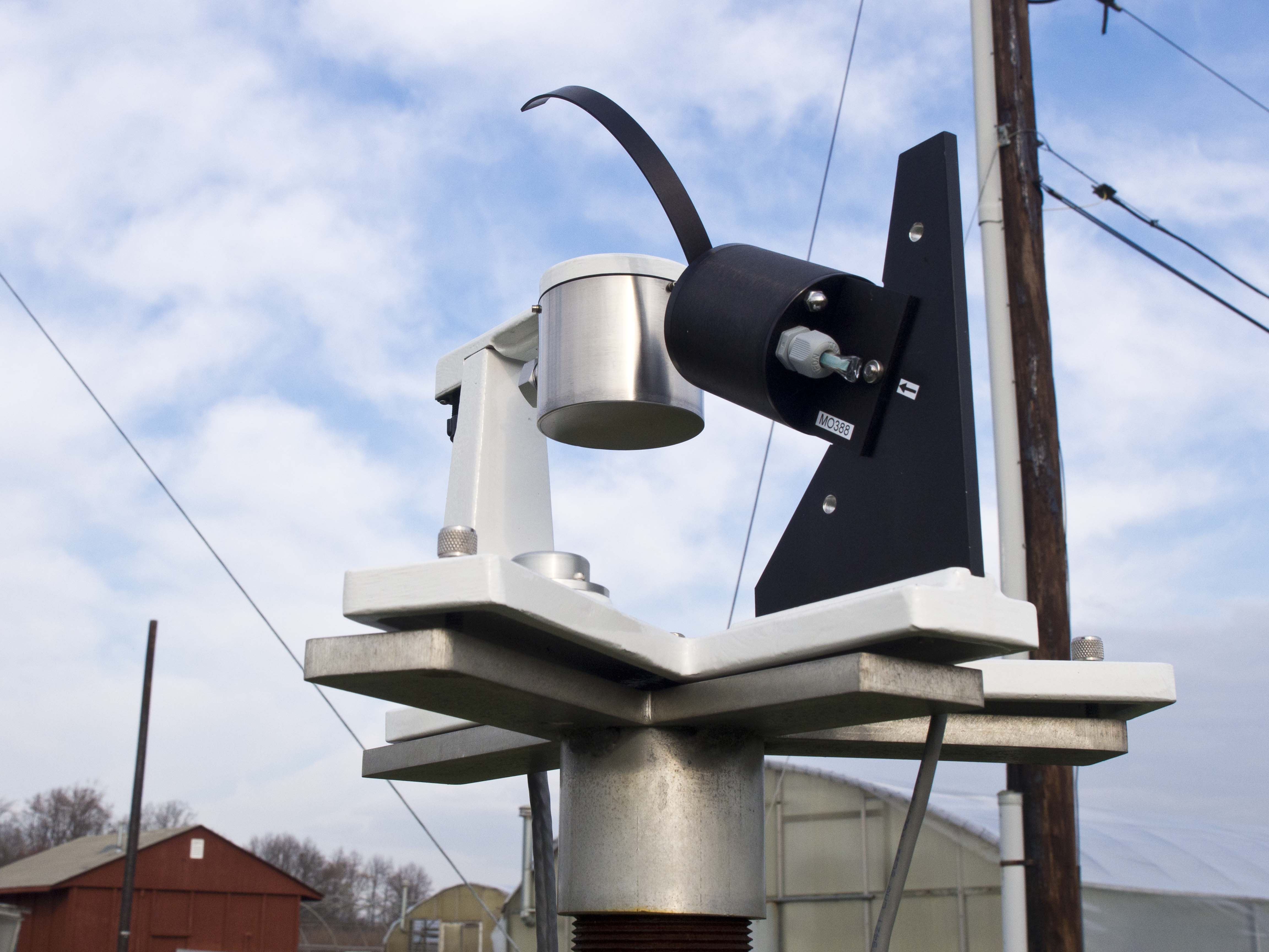
Yankee Environmental Systems Multi-Filter Roatating Shadowband Radiometer (MFRSR-7)
Location(s): Ground level.
Output: Solar Irradiance
Installed: 2015
Description: An MFRSR is a field instrument that measures the total, diffuse, and direct normal compoents of the spectral solar irradiance. More simply put, this instrument can figure out how much incoming sunlight by indiviual wavelength is shining down on the Earth. In addition to making total sunlight measurements, it also has a rotating arm that moves every few seconds to block the sensor from just the sun, which allows you to see how much sunlight is hitting the instrument that isn't coming directly from the sun (ie first scattered by our atmosphere). If you have the diffuse, and you have the total, by subtracting one from the other you are then able to then get the value for direct.
These measurements are essential for understanding how our atmosphere scatters incoming sunlight.
Upper Atmosphere Measurements
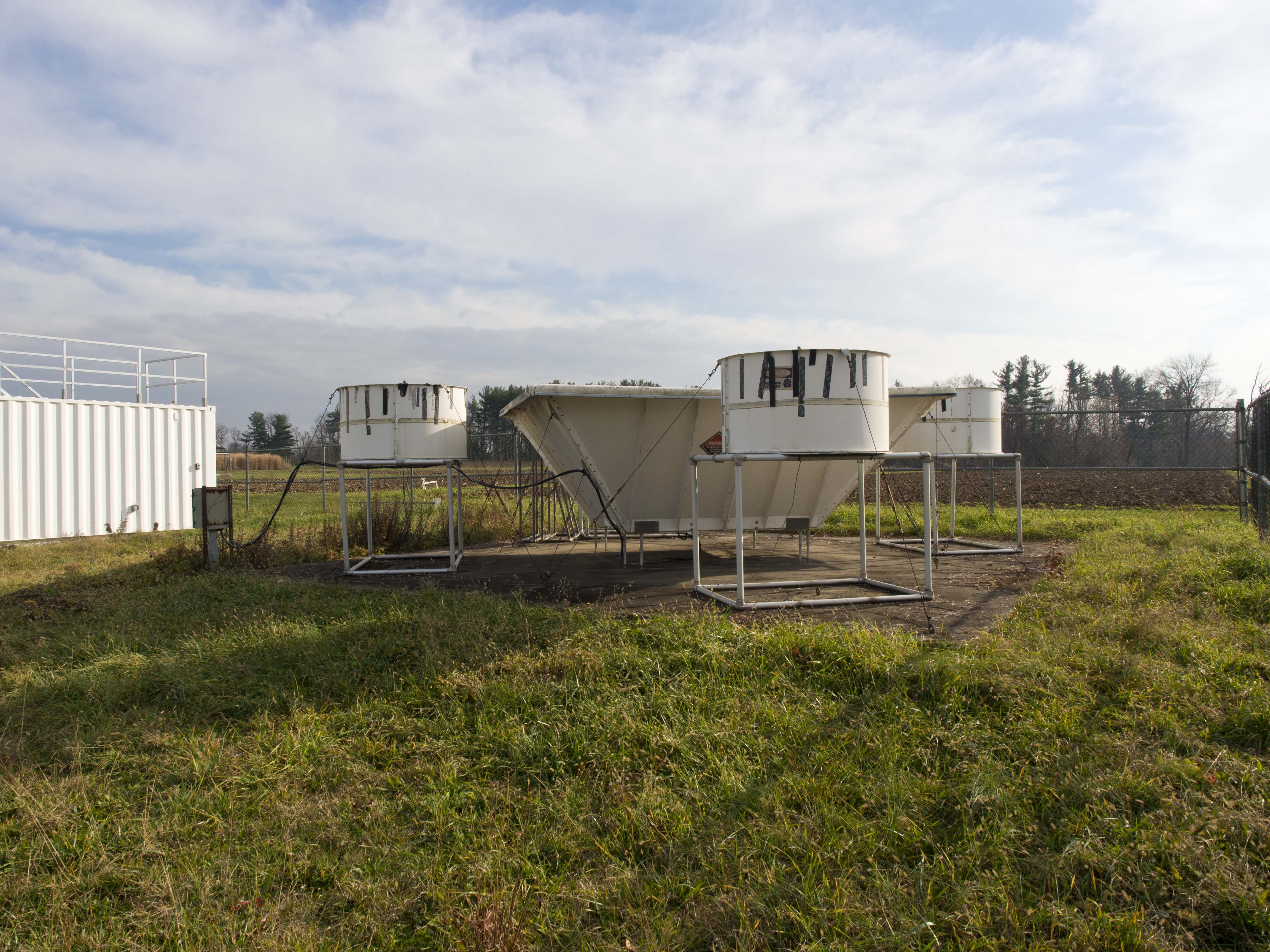
Vaisala LAP-3000 915 Mhz Wind Profiler
Location(s): Ground level.
Output: Wind Speed and Direction & Virtual Temperature
Installed: 1993, digitally upgraded 2013
Description: The wind profiler is used to obtain wind and temperature measurements to heights ranging from the surface to about 6,000 meters (~20,000 feet). It consists of a large, square, vertically pointing radio antenna, surrounded by four smaller sound transmitters (audio speakers). For measuring winds, radio signals are transmitted by the antenna located at the base of the antenna, which is steered electronically to point vertically and at small angles away from the vertical, towards the northeast and the northwest. Through these measurements based on how the radio signals move and are reflected back down to the receiver (See: Doppler Shift), an accurate profile of the wind speed and direction can be recorded.
For the first 5 minutes of every hour during the day, the four speakers surrounding the antenna emit a warbling high-pitched whistle that mechanically vibrates the column of air above the antenna. These vibrations affect the radio signals, and the speed at which the vibrations travel can therefore be measured. Since the speed at which sound vibrations travel through the atmosphere depends on the air temperature, the measurements can be processed to yield information about the virtual temperature profile of the atmosphere at heights ranging from 100 to 1300 meters (330 to 4300 feet).
Severe Weather Detection
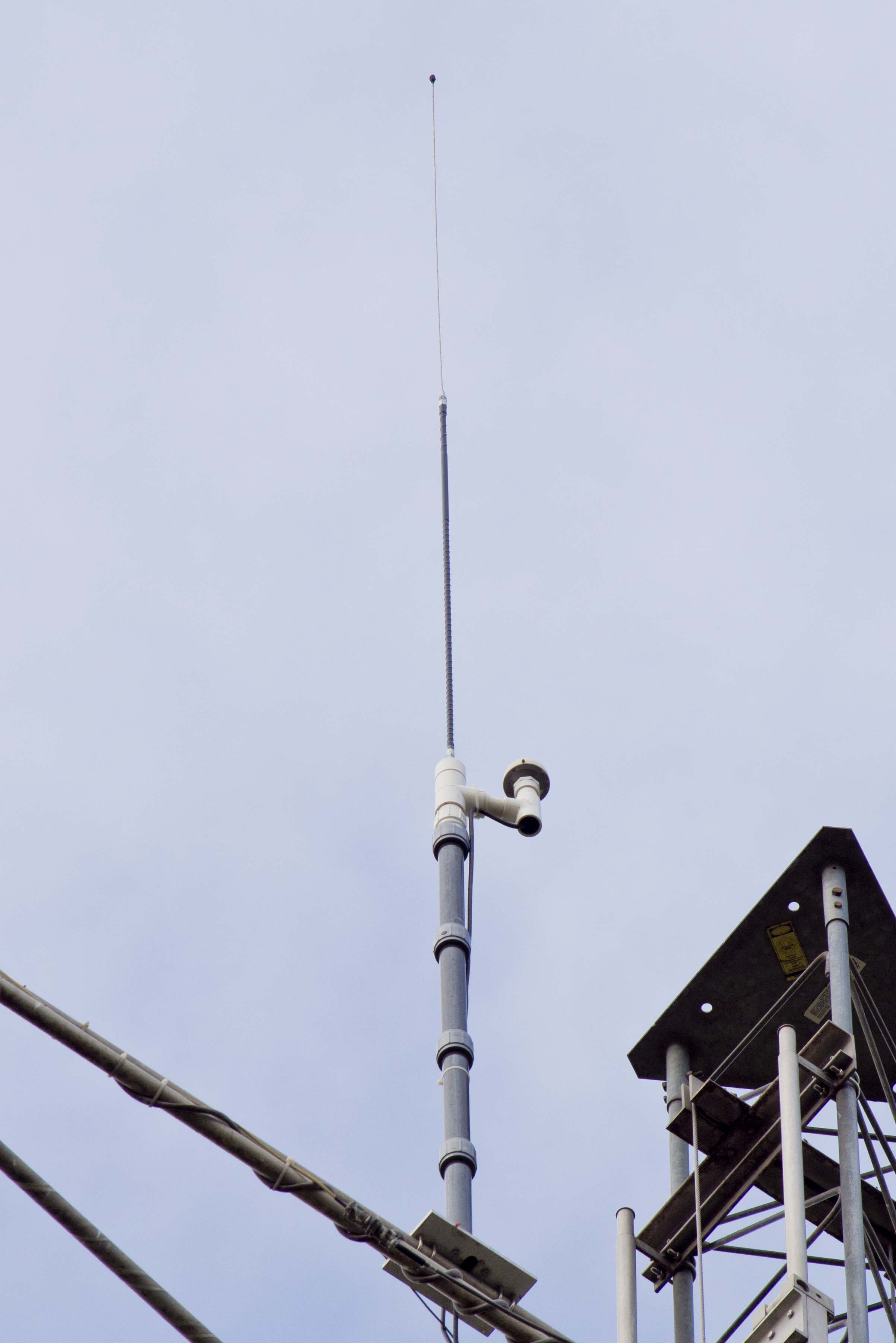
TOA Systems Lightning Strike Detector
Location(s): Met tower, 20 meters about ground level.
Output: indicates when a strike has been detected
Installed: 2014
Partnership: WSI Inc, USPLN/NAPLN
Description: This lightning detector is part of the United States and North American Precision lightning detection networks. When a lightning bolt strikes somewhere nearby, this and the 2 closest other sensors in other places in the network will all detect the bolt. Knowing the GPS coordinates of each detector, WSI is then able to triangulate to a high degree of accuracy exactly where the lighting strike went down.
This technology is responsible for the maps you often see on weather apps and television broadcasts that show where lightning is striking while a storm is passing through.
**Note: the detector is not designed to attract lighting, or survive a direct strike, but merely to observe one.